

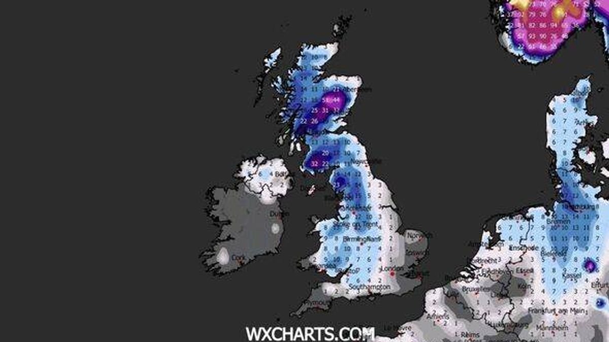

Multiple regions in the UK are on alert for another round of snow before the end of the month. The return of Arctic conditions could bring blizzards with the potential for up to 50cm of snow in certain areas and temperatures dropping to as low as -13C. Recent weather maps from WXCharts suggest that Scotland, north-west England, parts of south-west England, and Wales might see snowfall rates of up to 10mm per hour on Thursday, January 29.
This could result in snow accumulations up to 30cm in various English regions, including Manchester, Blackpool, Birmingham, the Midlands, Bristol, parts of Somerset, Devon, and London. Northern areas, especially the north of Scotland, previously impacted by Storm Goretti, could experience snow depths of 50cm, while the north-west of England may see accumulations reaching 23cm based on the same projections.
A significant drop in temperatures is expected, with parts of Scotland potentially facing a bitter -13C, while temperatures around the country could fall to approximately -4C. The Met Office has also noted the possibility of more snowfall before the end of January. Their forecast for January 20 to 29 indicates a battle between Atlantic weather systems from the west and high pressure bringing colder conditions from the east. Initially, milder Atlantic air is predicted to dominate, leading to often cloudy and changeable conditions with showers or longer spells of rain, particularly in western areas.
Later in the forecast period, the chance of colder weather increases, potentially bringing snow to parts of the country. This follows the recent ‘multi-hazard’ event, Storm Goretti, which brought strong winds and heavy snow to the UK, prompting a red weather warning earlier this month.