

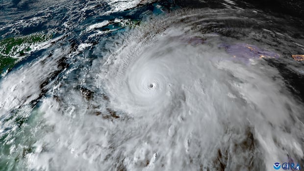

At the moment, this Atlantic hurricane season has seen only six named storms, with the majority lasting just a few days. So, what’s happening? Why is there a lack of hurricane activity?
“Typically, we would attribute this to four or five different causes, but this year, we can largely attribute it to El Niño,” stated Phil Klotzbach, a senior research scientist in the Department of Atmospheric Science at Colorado State University.
“It is an extremely powerful event.”
The current “super” El Niño is significantly suppressing hurricane activity in the Atlantic.
El Niño is part of a natural cycle known as the El Niño-Southern Oscillation (ENSO), which involves interactions between ocean temperatures in the central Pacific and atmospheric winds.
An El Niño event is indicated when the water temperature is at least 0.5 degrees Celsius warmer than average over a specified period, while a temperature of -0.5 degrees Celsius cooler signifies a La Niña event. These oscillations have global impacts.
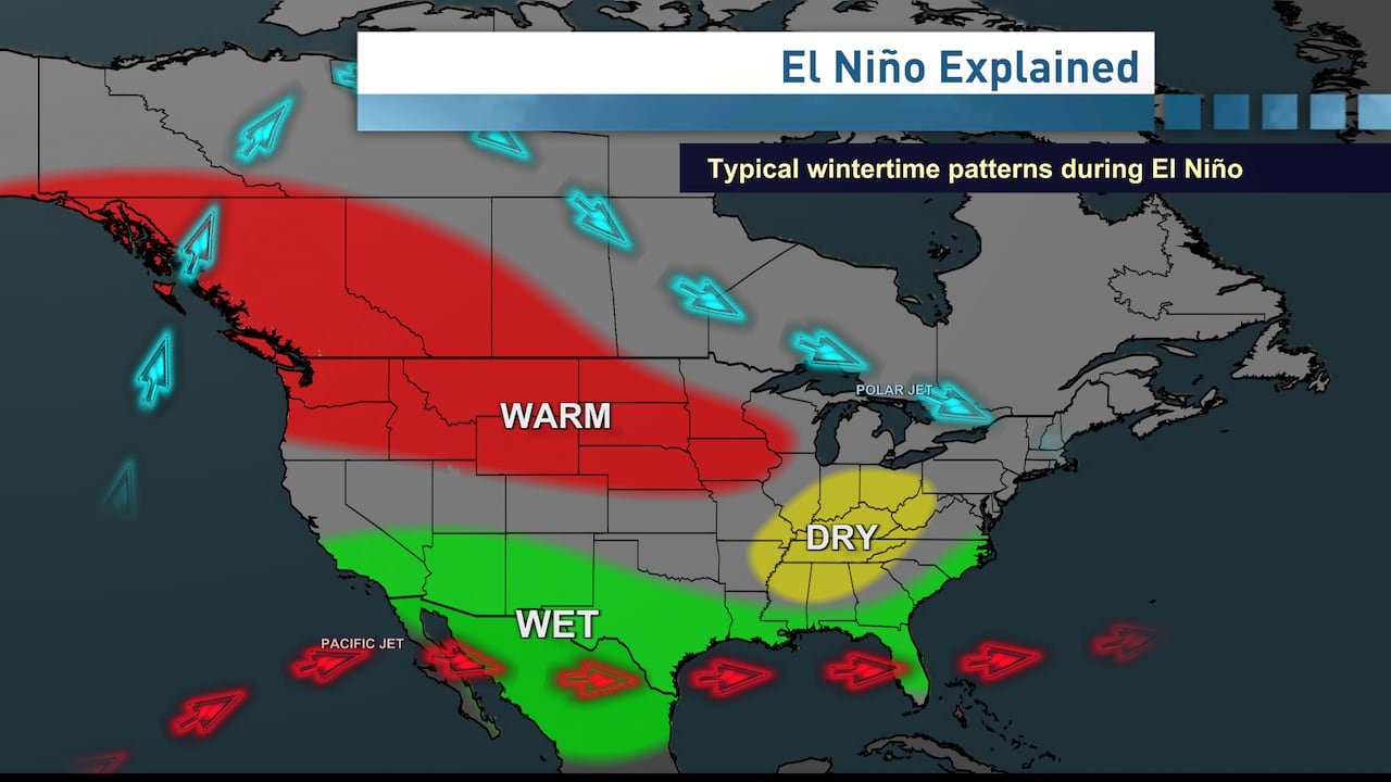
During a typical El Niño, an amplified polar jet stream often leads to warmer than normal temperatures in much of western Canada during the winter season. (CBC News)
Currently, an El Niño advisory is in effect, with several models indicating that this could be a record-setting event.
“The anomalies are becoming so pronounced that we may see an anomaly exceeding 2.4 degrees Celsius, which is our historical record from the winter of 1982 and 1983. We are anticipating anomalies of around 2.6 to 2.7 degrees Celsius,” explained Lindsey Long, a meteorologist at the Climate Prediction Center of the U.S. National Oceanic and Atmospheric Administration (NOAA).
“So, we are looking at a very strong event, with a 75 percent chance of it being historic. There’s over a 90 percent chance of it being very strong, marking the highest level in our categorization at NOAA.”
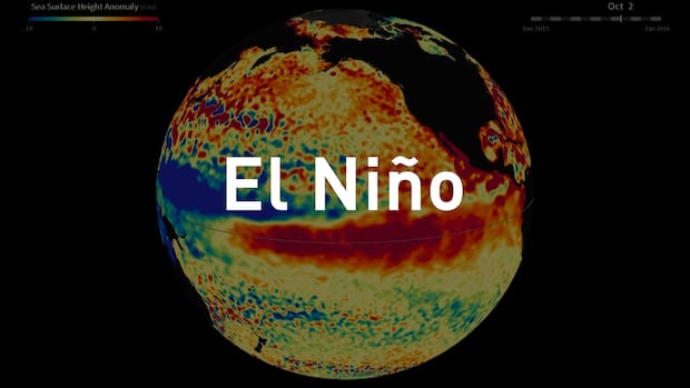
It’s set to be a record-breaking few months of weather, driven by a “super” El Niño. As Johanna Wagstaffe explores, a natural surge of warm ocean water is colliding with a planet hotter than ever before, bringing more extreme heat, floods, and droughts. But this “super” El Niño could also help us prepare for what’s coming.
The calm season has not taken forecasters by surprise. In May, NOAA predicted eight to 14 named storms and three to six hurricanes. By August, that forecast was adjusted to estimate seven to 13 named storms and two to six hurricanes.
How does something in the Pacific influence the Atlantic?
How can events occurring thousands of kilometers away in the central Pacific affect the Atlantic?
Long clarified that elevated sea surface temperatures in the eastern Pacific tend to generate vertical wind shear in the Atlantic, characterized by strong upper-level winds and weaker lower-level winds.
“This disrupts the hurricane structure that is typically favorable,” Long noted. “Hurricanes thrive on verticality.”
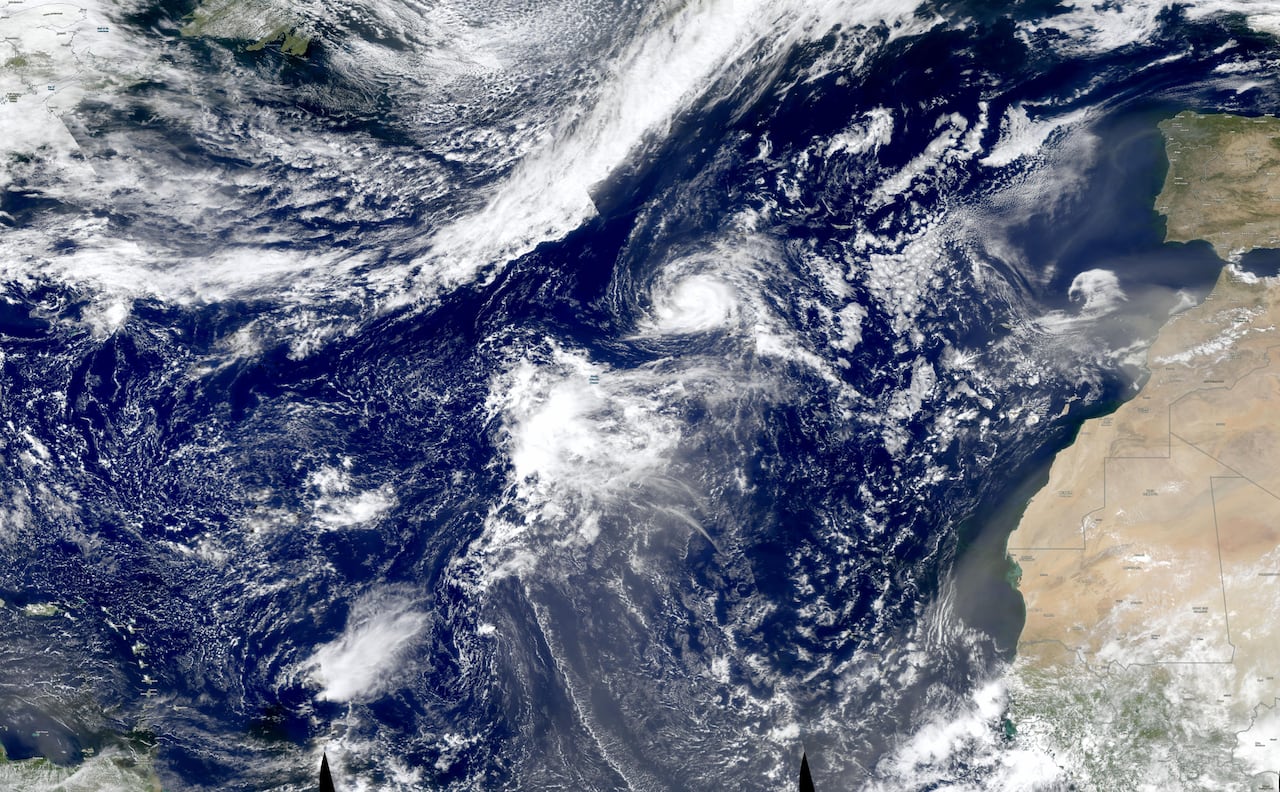
Tropical Storm Fay (right of centre) is seen in the Atlantic Ocean on Sunday, Sept. 20, 2026. The storm came very close to being the first named hurricane of the season. (NASA/EOSDIS)
The shear has been exceptionally intense, making this quiet Atlantic hurricane season potentially one for the record books.
“Usually, by mid-October, the season starts to taper off,” Klotzbach remarked. “To borrow a phrase from baseball — Yogi Berra used to say, ‘It’s getting late early.’”
He mentioned that a sudden increase in activity is unlikely, though one or two hurricanes could still emerge.
-
‘Super’ El Niño didn’t cause this year’s fires and heat waves, but it’s about to take us on a ‘wild ride’
-
This year’s Atlantic hurricane season expected to be below average, thanks to El Niño
“I would be surprised if we end the season with no hurricanes, but the likelihood of anything significant developing from the deep tropics is quite low.”
Nonetheless, there remains a possibility for one to form in the warm waters of the Gulf of Mexico.
“The Caribbean still experiences considerable wind shear, so the potential for development there is likely low, but in the Gulf of [Mexico], we are observing less wind shear,” Long stated. “Thus, there is a chance for some formation either there or off the U.S. east coast.”
Not quiet everywhere
However, El Niño generally produces the opposite effect in the Pacific Ocean, leading to increased hurricane activity.
So far, there have been 16 named storms in the Pacific, with another likely to emerge shortly after this report.
The Atlantic region came very close to witnessing its first hurricane last weekend.
As per meteorologist and hurricane specialist Michael Lowry, Tropical Storm Fay, which originated as a tropical depression on Saturday, achieved wind speeds of 112 km/h, just shy of the Category 1 hurricane threshold of 119 km/h.
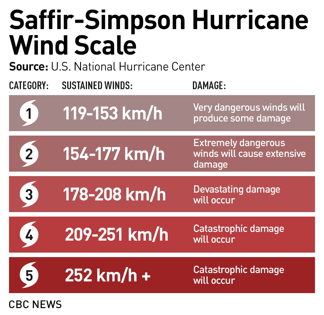
The Saffir-Simpson hurricane scale gives you an idea of what a Category 5 storm means. (CBC News)
Interestingly, Fay developed significantly farther north than the typical formation zone for most Atlantic hurricanes. Most hurricanes form around 20 degrees north latitude, whereas Fay formed at approximately 32 degrees north.
While this El Niño is cited as the reason for the scarcity of hurricanes in the Atlantic, it’s crucial to recognize that there have been a few brief tropical storms in the Gulf of Mexico that have affected coastal communities, including those in Louisiana.
This El Niño is projected to peak in November or December, although it will continue into 2027. The implications for next year’s hurricane season remain uncertain.
“Generally, the year following an El Niño is characterized by the absence of El Niño and a warmer Atlantic. Thus, we cannot definitively predict a busy hurricane season next year,” Klotzbach noted.